|
ARCHIVE: CSF
SELECTED PROJECTS
ChildInfo Data Base and Mapping Information
System, UNICEF,
from 1996 up to, but not including, ChildInfo2.
|
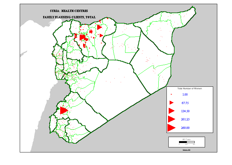
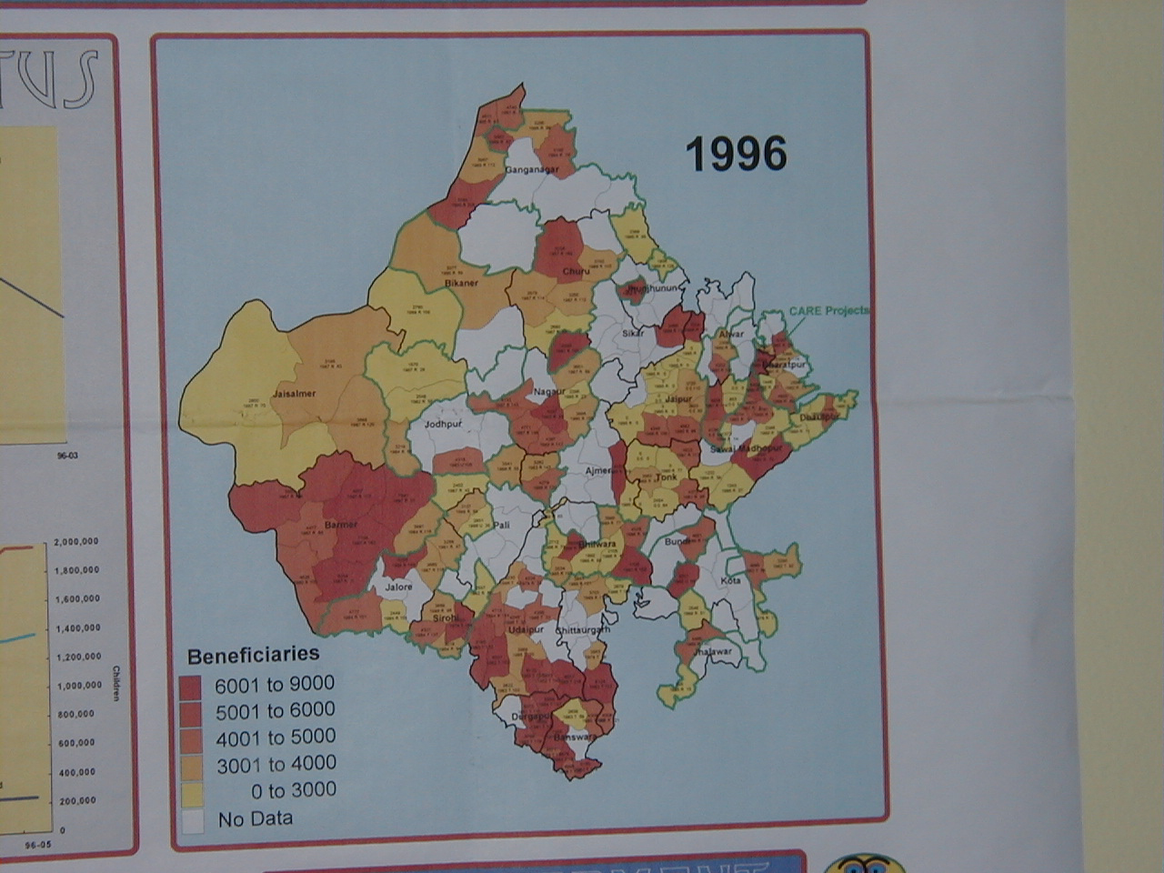
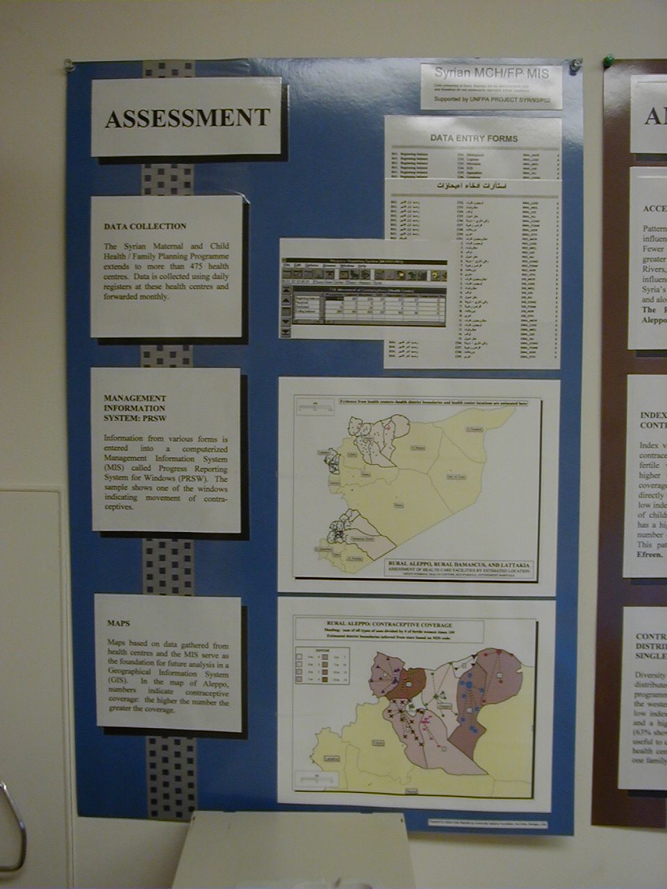
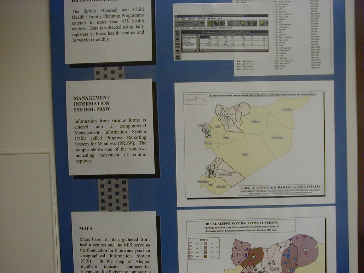
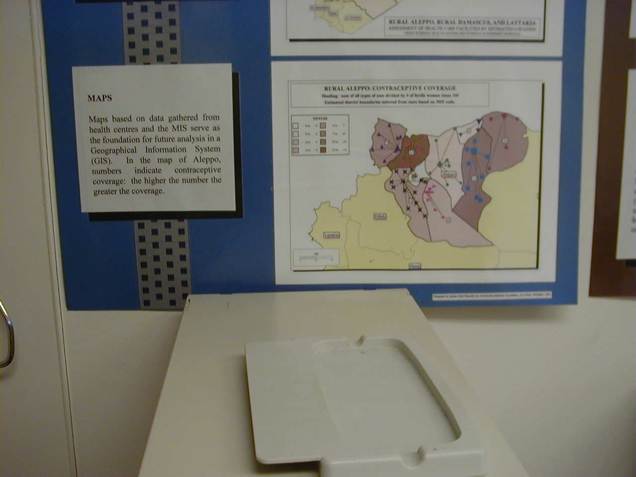
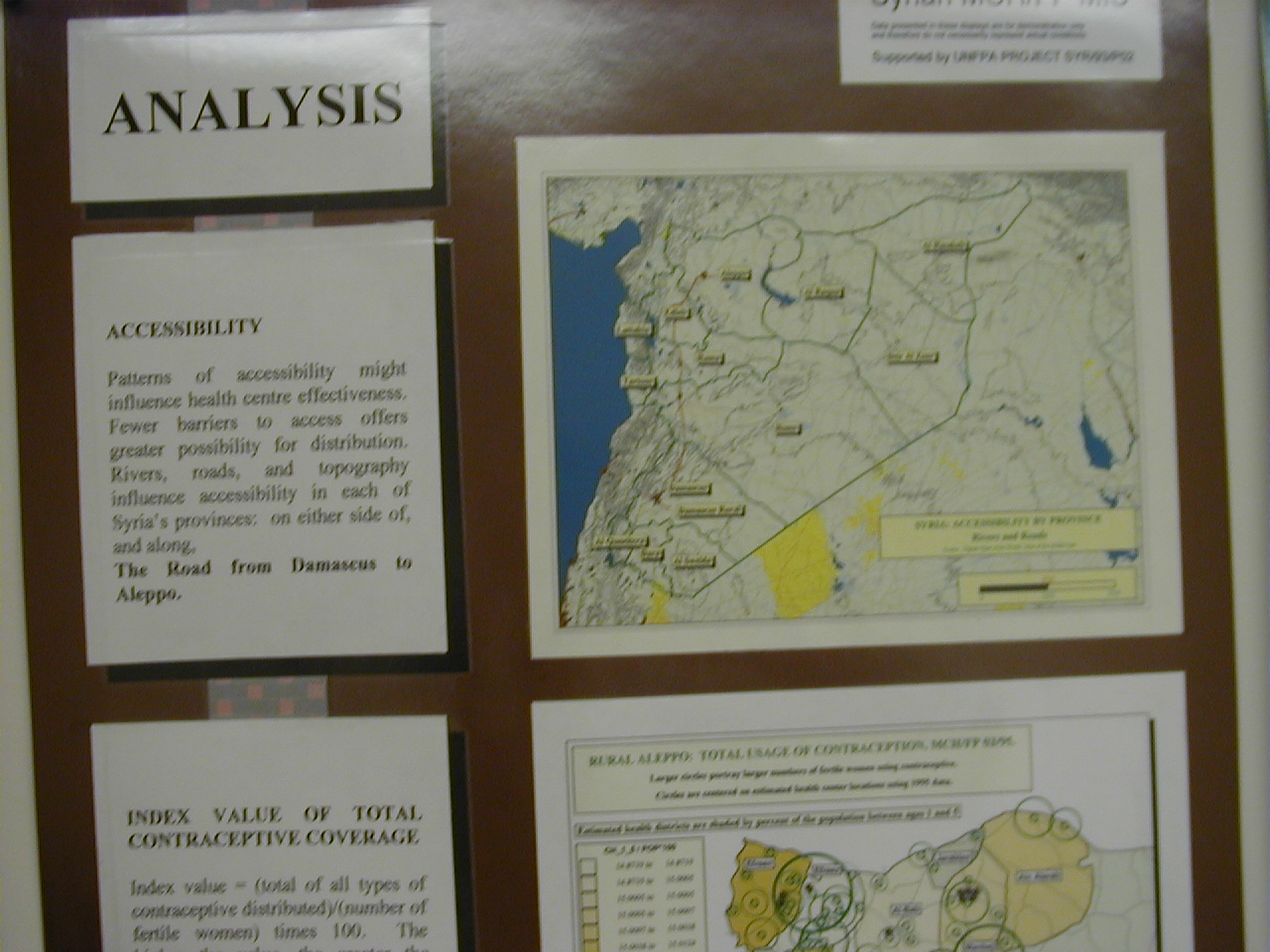
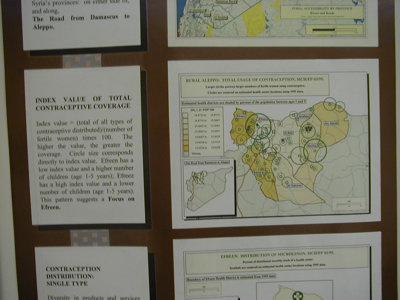
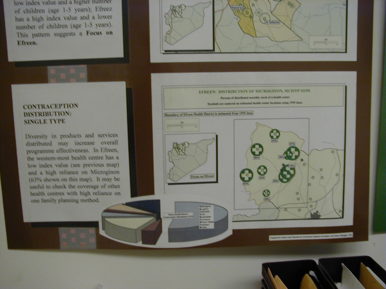
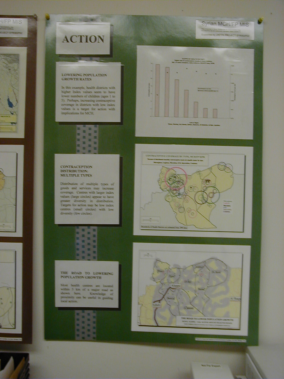
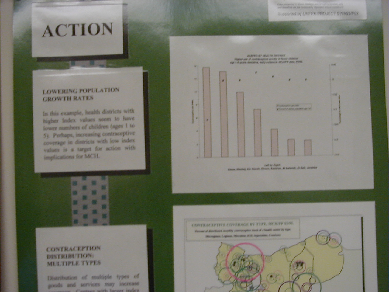
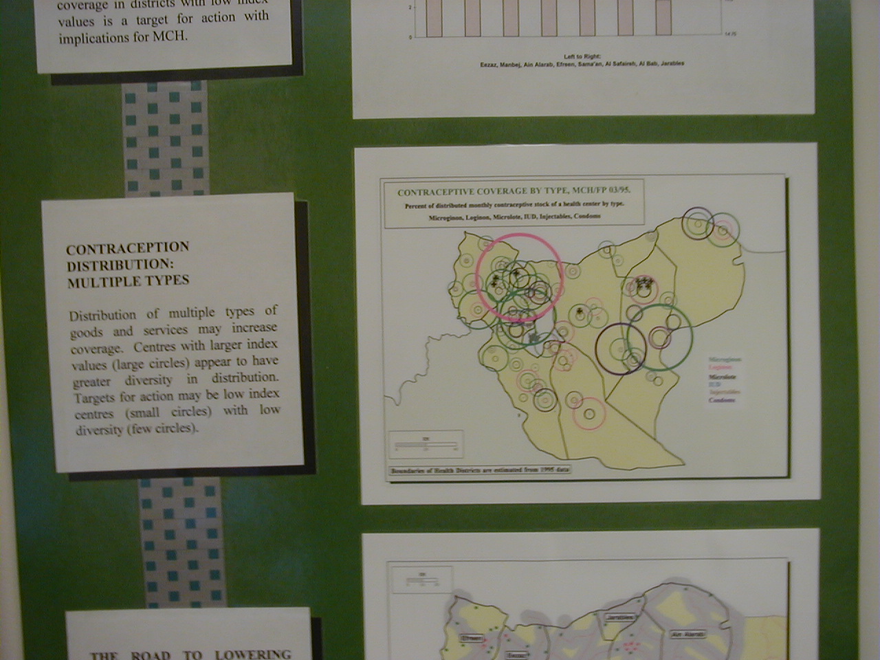
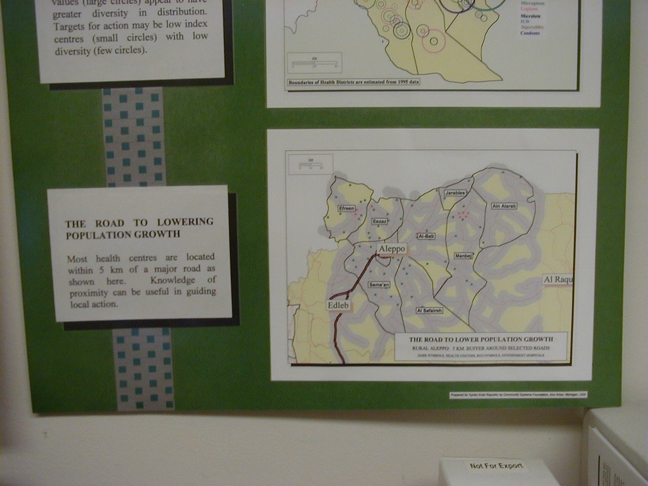
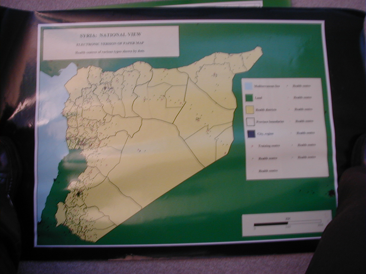
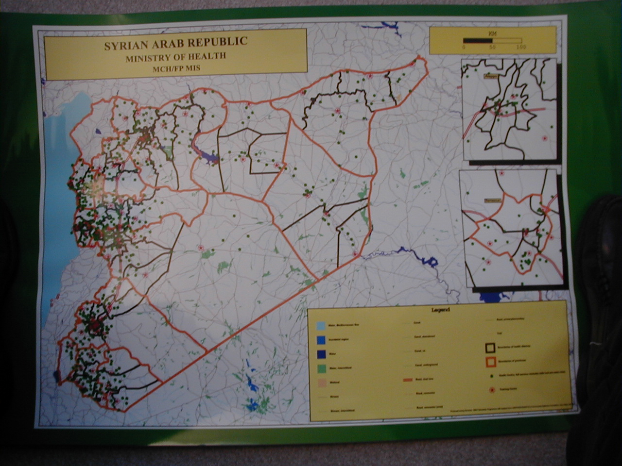
Syrian
Ministry of Health, Maternal and Child
Health
Care /Family Planning, MIS, UNFPA. 1992-1997.
Map boundaries provided by MOH.
|
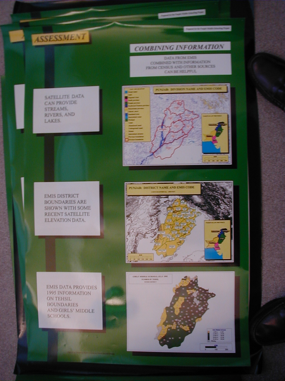
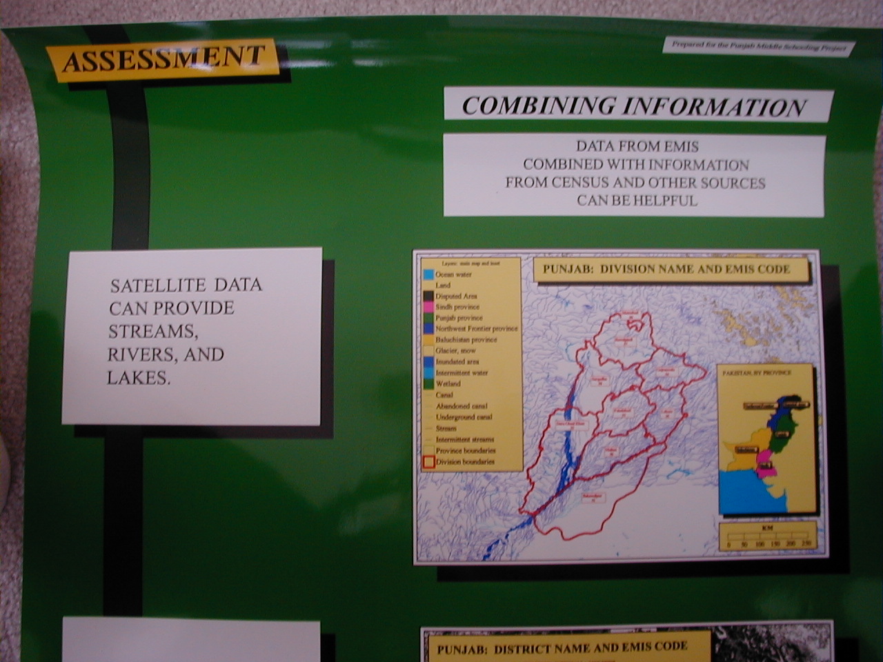
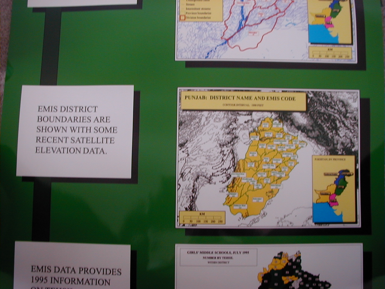
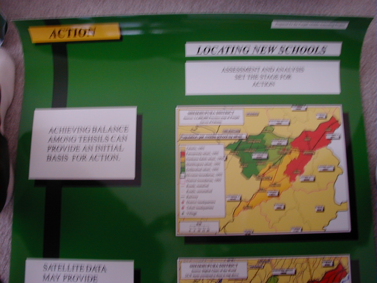
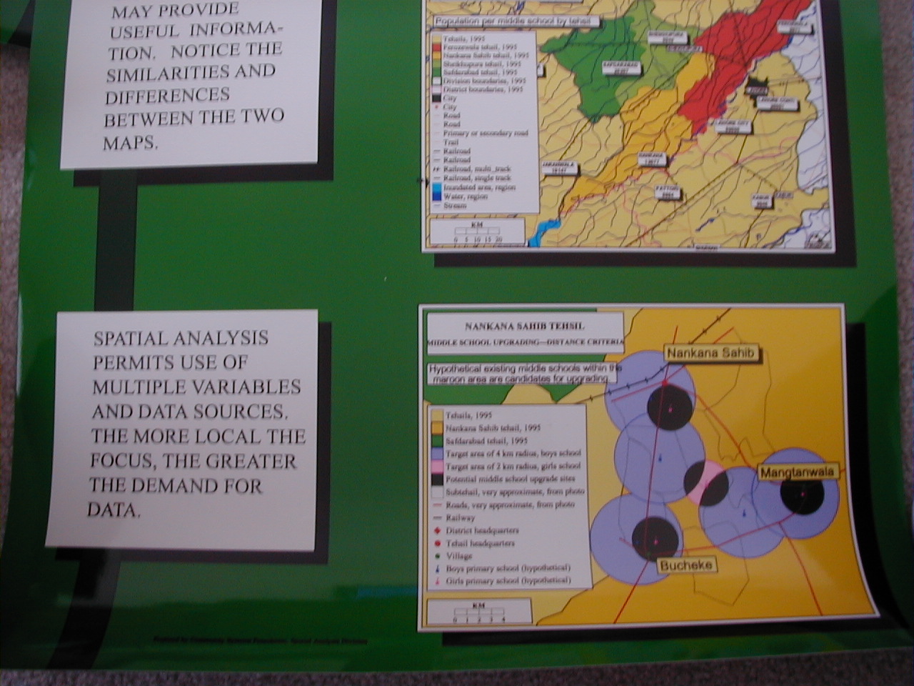
Punjab, Pakistan, Middle Schooling
Project,
Academy for Educational Development and
World Bank. 1995-1997.
- Posters
prepared for the Punjab Middle Schooling Project,
displayed as
PowerPoint slides.
- Feedback:
Sheikhupura District. The making of a map of many layers from
locally obtained data.
- Maps
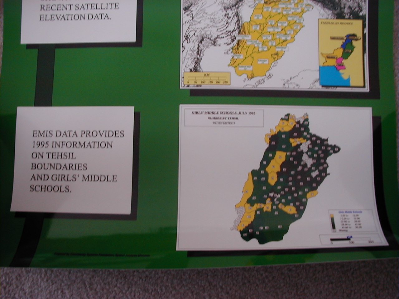
from Satellite
Data: A Poster prepared for the Punjab Middle Schooling
Project.
- Punjab
School Mapping Project: Maps
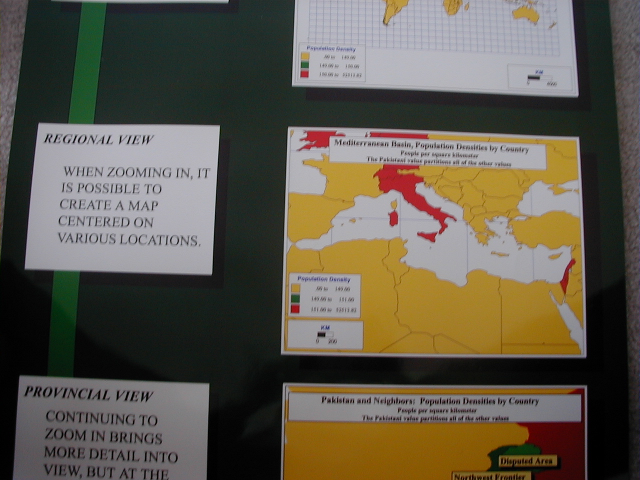
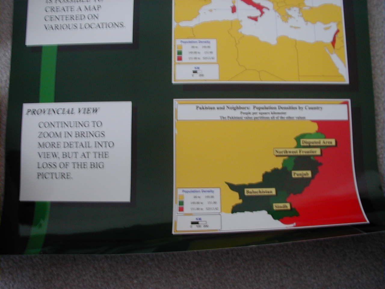
- Zooming
In:
A Mini-poster prepared for the Punjab Middle Schooling Project.
- Punjab:
1981 and 1995. Boundary comparisons by tehsil, district,
division.
|
Samples of photos of posters from previous
projects;
photos taken using a 1.3 megapixel digital camera (at SHQ mode--36
images
on an 8MB chip).
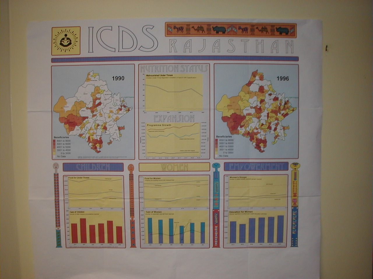
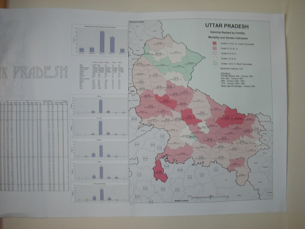
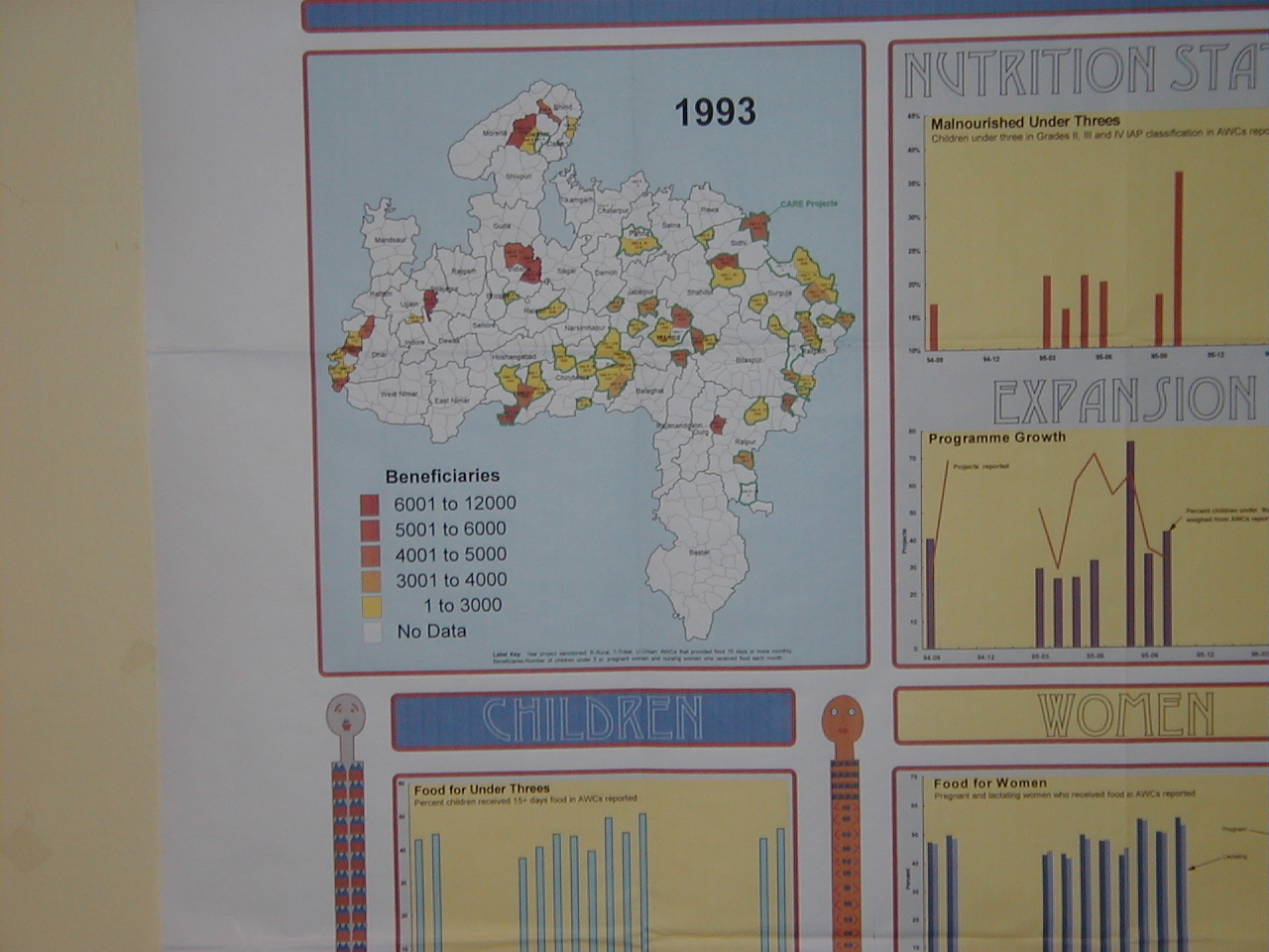
- India (KO); 1,2,3,4,5
- Syria (SA)
- Pakistan--Punjab Middle
Schooling
(WD
and SA)
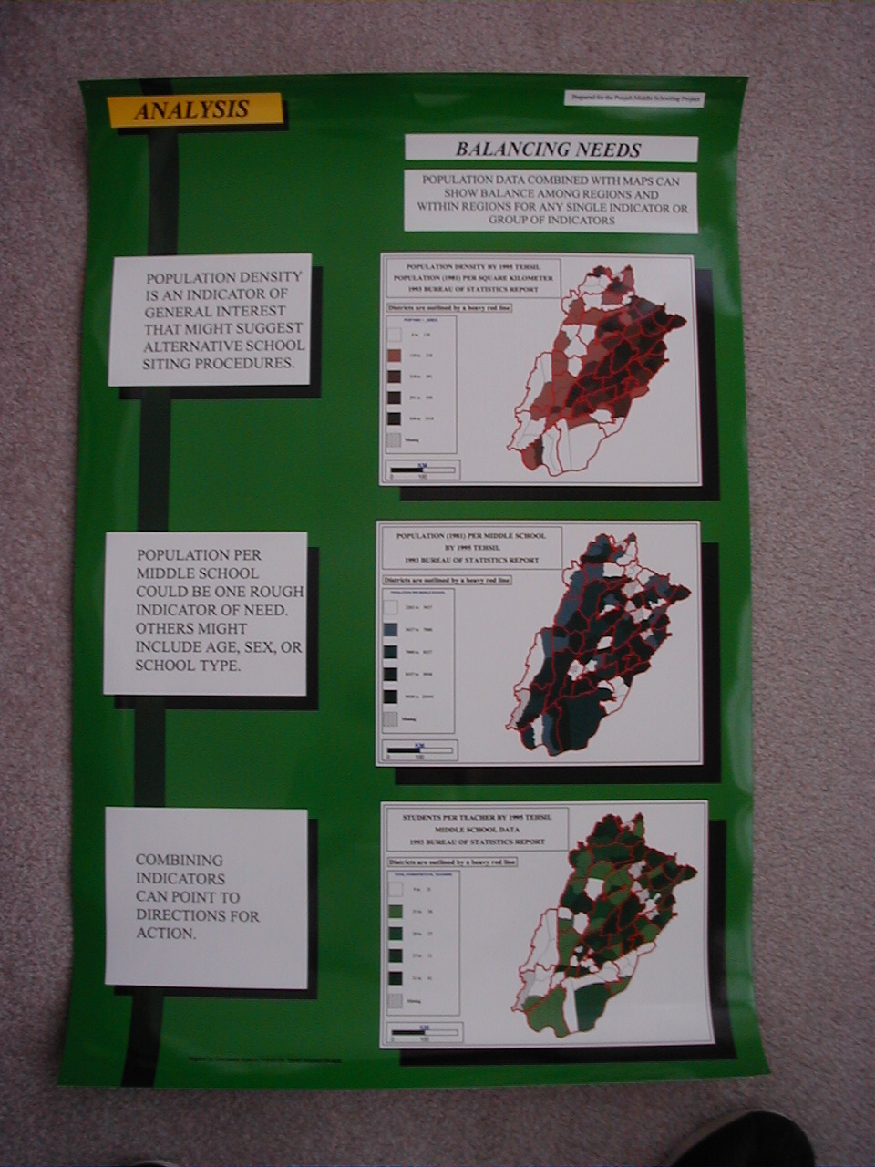
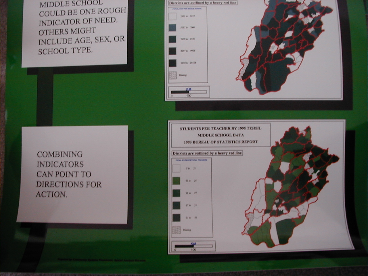
- Assessment: top, middle, bottom
- Analysis:top, middle, bottom
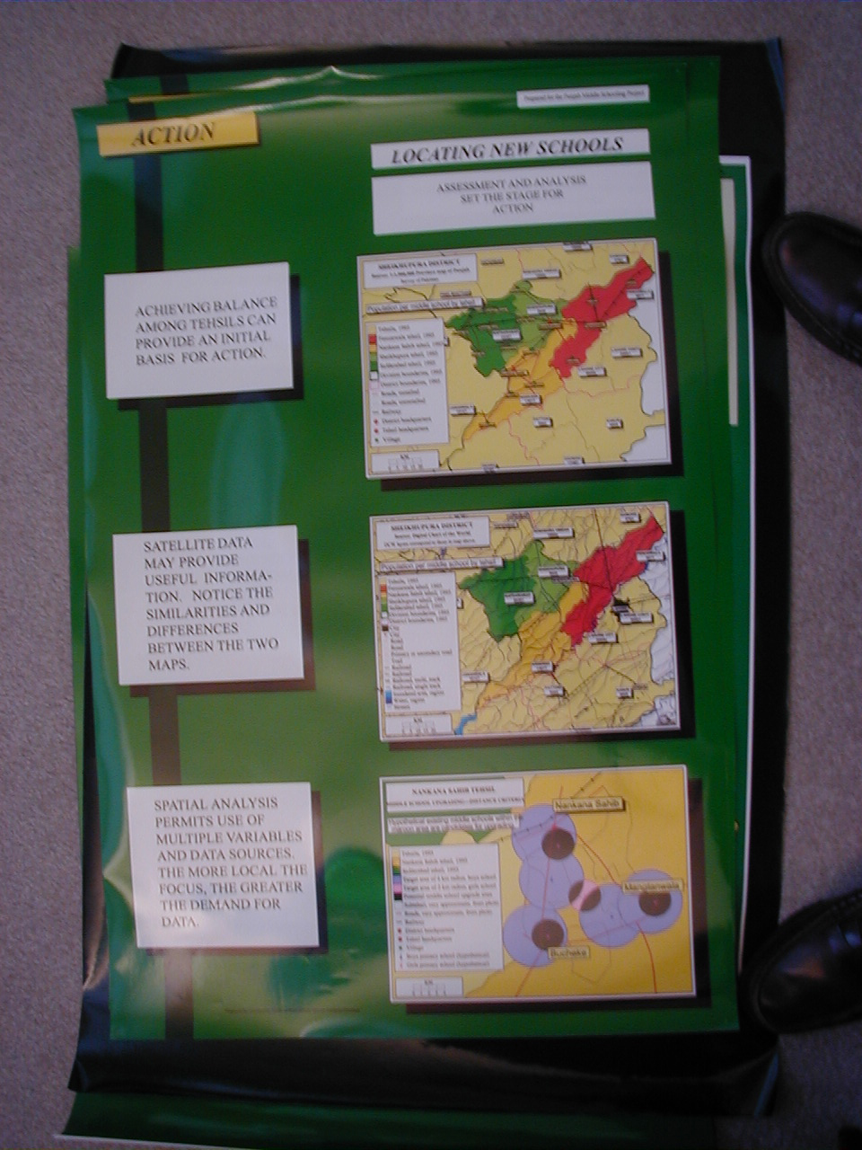
- Action:top, middle, bottom
- Zooming
In: top,
middle,
bottom
- Maps
from Satellite Data:top, middle, bottom
|
|
