 |
 |
|
|
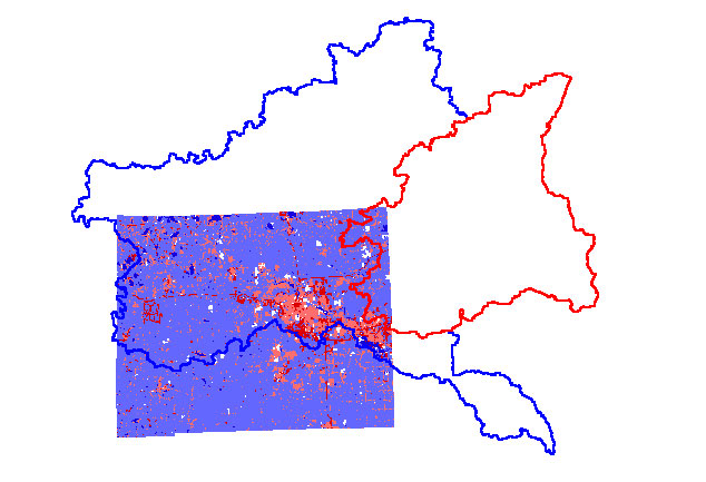
This map show the estimated impervious surface divided by area for Washtenaw
County which is the most populated county within the borders of the Huron
River Watershed.
 |
 |
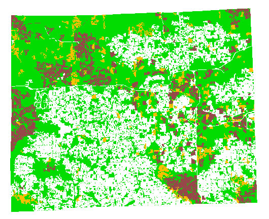
This map illustratws the percentage of impervious surface on a particular parcel of land within Washtenaw County. The white areas which predominate this map represent areas where data is still unavailable.
Similar to the map above there was little data dealing with impervious surfaces for all counties that were in the either the Huron or the Rouge River Watersheds. As more data becomes available, I hope to complete the missing areas in each watershed.
***Please note that these parcels of land were divided by the Southeastern
Michigan Council of Governments and do not correspond with city or township
divided parcels.