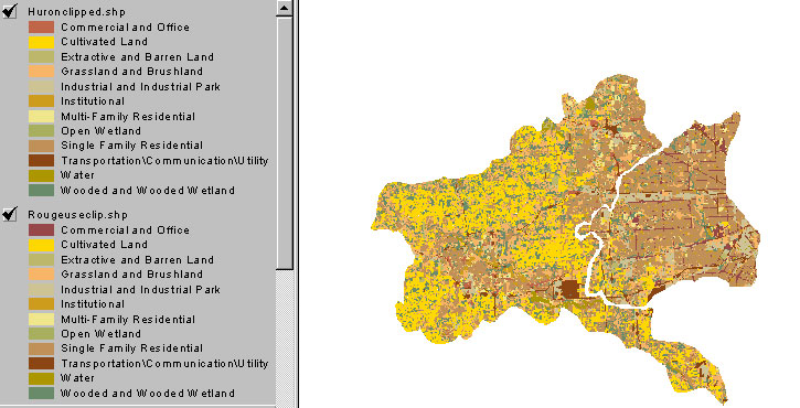
This map illustrates the differences in land use between the two watersheds. It is quite apparent that there are distinct differences between the two watersheds that may contribute to the water qualities in these two rivers.
The Huron River Watershed is predominately covered by cultivated land and single family residential. The implications of having a large portion taken up by agricultural uses are numerous. For instance, runoff from these areas of land use would contribute to higher than normal levels of phosphates and nitrates. Because this type of land use is often void of vegetation at different times throughout the year, erosion of the soil may be a problem causing decreased quality for turbidity, dissolved oxygen, temperature, and total solid values. The large portion of residential use in the watershed would lend itself to large quantities of impervious surfaces, which during heavy rainfall could potentially reach their maximum carrying capacity leading to combined sewer overflow, one of the leading causes of decreased water quality in both watersheds.
Similarily, the Rouge River Watershed is dominated by residential and industrial/commercial land use. Like the effects that these types of land uses might have on the Huron River Watershed, so to might they affect the Rouge River Watershed in similar fashion. However, a common misconception is that many of the pollution problems of the Rouge Watershed is due to industry; this is not the case. While industry does contribute to pollution of the Rouge Watershed, its effects are minimal compared to those caused by combined sewer overflow.