Maps may utilized to analyze data in an array of formats. One such tool is the dot density map. By creating two layers and using a dot to represent data, dot density maps arrange data in an clear, easy to use format.
Below is a map of Wisconsin and Michigan, comparing population of the two states in 1999. At first glance, the data is clear to read and well organized.
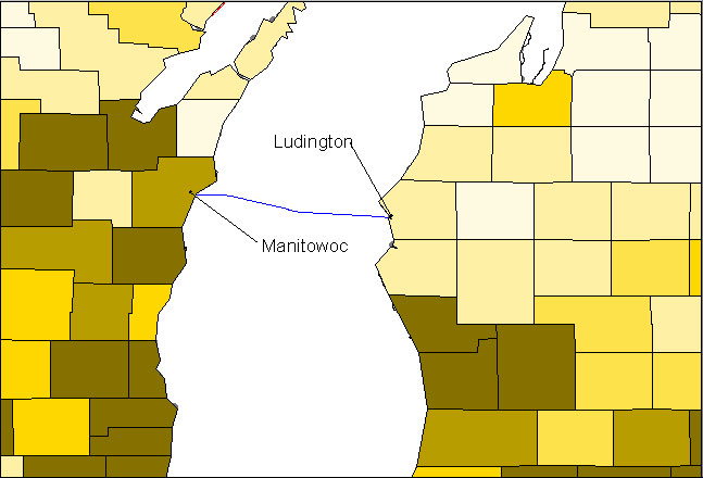
Population map of Eastern Wisconsin and Western Michigan. See Scale Below
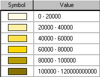
Although it is a nice map, looking at the legend does distract from the map. Now look at the dot density map below. This map also conveys population per area, yet it is formatted in such a way that the user can easily pick out the more populated areas.
Population Map of Michigan and Wisconsin One Dot = 1000 people
Not only one may gather population data from dot density maps, but one may integrate the maps as a tool. Below is a map detailing the housing in the Manitowoc, WI and Ludington, MI. By evaluating the maps, one can detect information about the two communities.
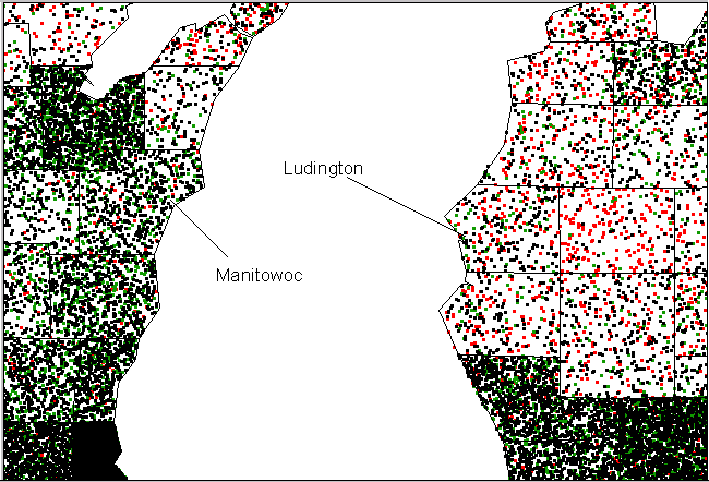
Household Population may of the Eastern WI and Western MI One Dot = 50 Households
Black = Owner Occupied Green = Rental Occupied Red = Vacant
Looking at the above map, one can see the different households in the two communities. As expected, the majority of households are owner and rental occupied. Now, look again at the Ludington area. There is a high number of Vacant households. Why is this? Is there a definite reason? Does this trend a part of the communities culture? To answer these questions, one has to explore the area. By creating a land use map (see below) one can notice that Ludington is in vicinity of some state and national parks.
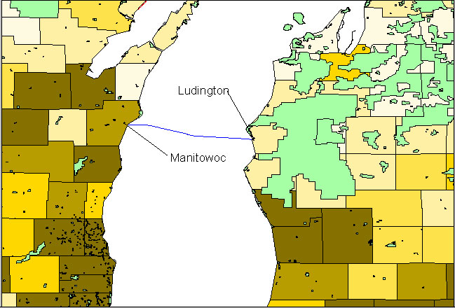
Because of the parks' location, many of the vacant households could possibly be seasonal homes. The census lists vacant households for partial residents, seasonal homes, and so on. To obtain further information on the classification of vacant households I would recommend visiting the U.S. Census homepage. Manitowoc is much more owner and rental occupied. This could be due to it's close vicinity to Green Bay, WI.
By just looking at the dot density maps, one can learn much about the differences and similarities of a community, yet one can also form misconceptions. Once common misconception is examined in the next GIS page.