 Land Elevation in Ann Arbor, MI
Land Elevation in Ann Arbor, MI
Land Elevation in Ann Arbor, MI Triangular irregular network (TIN) is a form of contour Digital Elevation Model (DEM). It is becoming increasingly popular, expressly in terrain mapping, due to it's ability to analyze irregularly spaced elevation data. TIN is a set of contiguous non-overlapping triangles. These triangles allow depth.
To explore TIN, I decided decided to study the land elevation of Ann Arbor, MI. Below is the map.
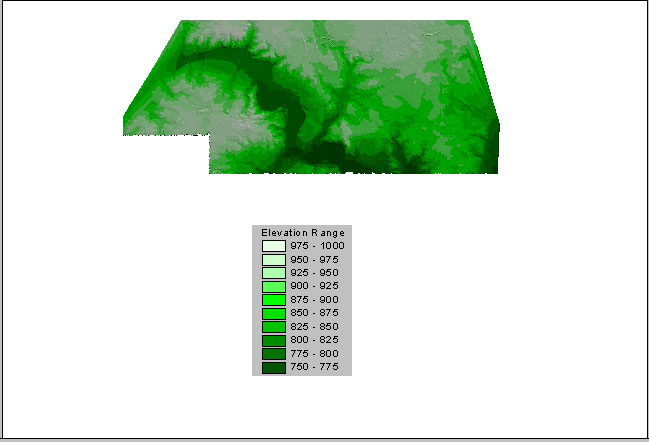
Elevation Map of Ann Arbor, Michigan
This is the top section of the city. The map does show a good representation of elevation, yet by focusing on the lower left quadrant even greater depth may be seen.
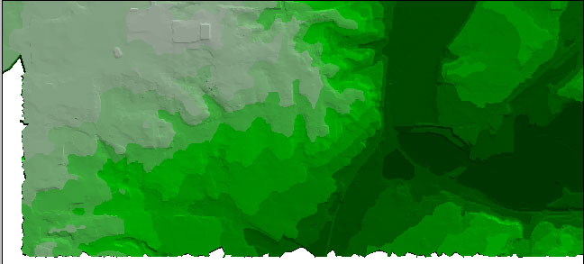
Elevation Map of Ann Arbor, Michigan, Downtown See above for Scale
How might these maps be used? I took the above map and overlaid the roads for a reference, and then added the land use. This was to see if there is any relationship between elevation and land use in this community.
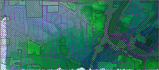
Elevation Map of Ann Arbor, Michigan with Land Use data
This map may be used by elevated on many scales. Urban planners, contractors, and landscape architects could use TIN to best elevate an area. Researchers could use such a map to discover natural links.
Do to its usability, TIN will become increasing popular. It is just one more example of how GIS may be used in everyday practices.
Silva, Claudio T. and et la. Automatic Generation of Triangular Irregular Networks using Greedy Cuts. http://www.cs.sunysb.edu/~csilva/papers/terrain/terrain.html
U.S. Geological Survey. http://www.usgs.gov/