The integration of local people into the management of biodiversity conservation projects is vital to their success, especially in politically unstable regions. Regions of the world with high biodiversity, endemism and high numbers of endangered species are often the focus of international conservation organizations. While the ultimate management objective of these organizations is the conservation of biological diversity these organizations are now considering and incorporating local populations into their management schemes. Local people are key collaborators in helping conservationists fulfill their agendas but also in maintaining their own environment and resource base for their own use.
The emphasis in some conservation projects has been changing from strict preservationist top-down measures that are designed to prevent human impact on an area in order to maintain a strict pristine environment for certain species. The newly designed conservation projects are attempting to incorporate participatory planning and co-management into their projects or at least trying to incorporate some activities into their plan that take local peoples needs and traditional resource use strategies into account. These conservation and development projects are now widespread. Without the full collaboration and co-management with local peoples the chances for true conservation and development are greatly reduced. Despite the changing planning strategies, however, on the ground, true collaboration and successes in terms of conservation and development are not often seen.
In regions where there is political instability the need for local people involvement is even more crucial. In the case of Niger civil unrest led to the temporary suspension of the conservation and development project in a protected area. It was the locals who had been involved in the project management who had the initiative to restart the project. The locals are the ones who remain in the area with ultimate control of an area to fulfill their own conservation objectives with what they have and with what they have learned with project staff. This case study demonstrates a positive, if abrupt, transition from "outside project" to "local people" initiated activities in and around a protected area.
Most conservation and development management plans are funded by outside sources and are of relatively short duration. The underlying premise is that the conservation of biological diversity can be better achieved if local people are integrated into the project. They will feel responsibility for the project and their resources and will manage them better. So the strategy is to train local people to take over the management of the project in preparation for the end of the outsiders presence and financial support. This transition is the most difficult step of them all and should be the focus of the management plan from the very beginning. This is especially true in cases where there is great political instability since the management transfer could come suddenly and unexpectedly.
Countries in Africa have varying percentages of their national land
area under protected status (Figure 1) and (Figure 2). Although the best
known ones are the large game reserves in East Africa there are many others
throughout the continent. One of the largest areas is found in the West
African country of Niger.
Figure 1. http://geography.miningco.com
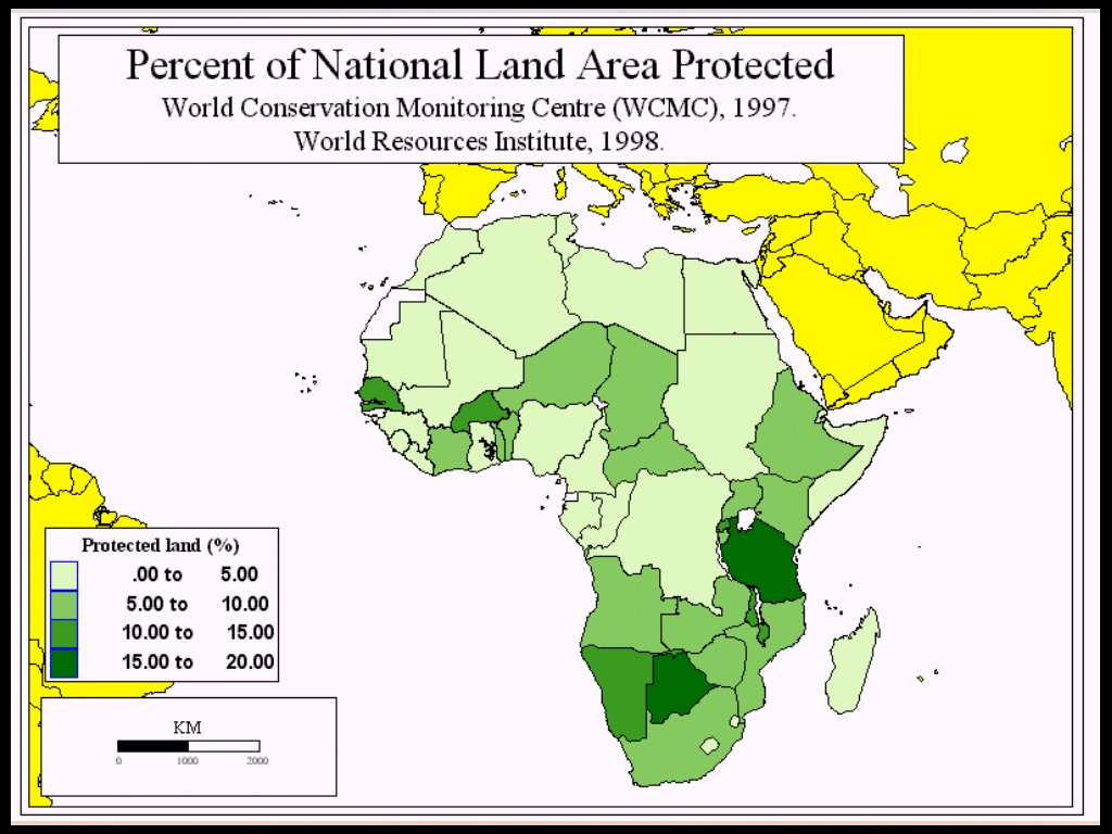
Figure 2. Source: WRI Database, 1998.
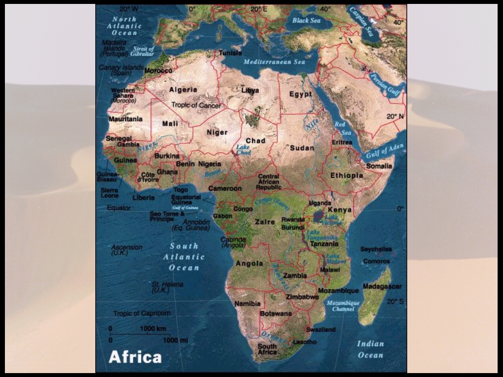
Niger (Figure 3) is a country in the Sahelian region of West Africa.
It covers 1,267,000 square kilometers. In 1997 its population was 9,389,000.
(Britannica, 1998) Nigers population has been increasing since 1950 and
is expected to keep increasing. (Figure 4) Its population density therefore
is also increasing. (Figure 5) In 1997 it had an average population density
of 7.4 persons/sq. km (Britannica, 1998). Niger is still a predominantly
rural country with 83% of the population in rural areas in 1995 and only
12% in urban areas. (Britannica, 1998)
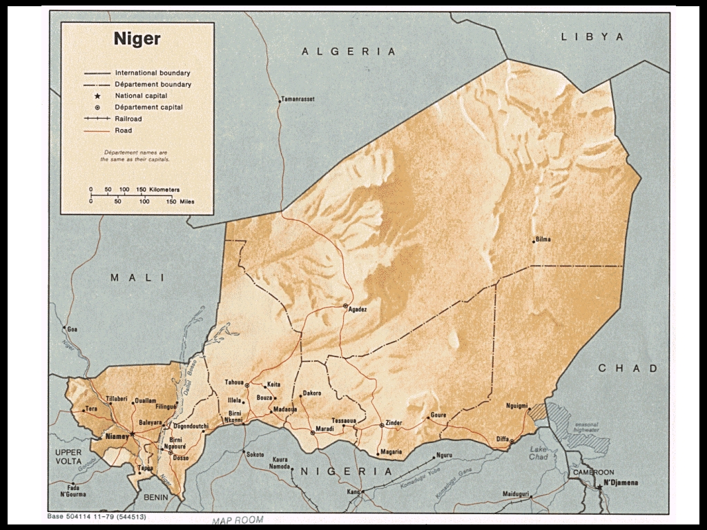
Figure 3. http://www.sas.upenn.edu/African_Studies/CIA_Maps/Niger_19876.gif
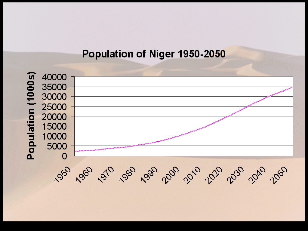
Figure 4. Source: WRI Database, 1998.
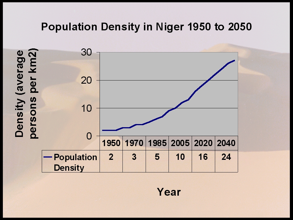
Figure 5. Source: WRI Database, 1998.
The human indicators for 1996 for Niger show a birthrate of 54.5/1000, death rate of 24.6/1000, total fertility rate of 7.4, and an infant mortality rate 117.6/1000 live births. In 1996 the life expectancy at birth was 41.1 for males and 40.2 for females. And in 1995 20.9% of males and 6.6% of females over the age of 15 were literate. (Britannica, 1998)
Niger contains six protected areas. The total area under protected status is 96,967.4 km2. Niger has protected 7.7% of its area. (IUCN, 1991, p206; WRI Database 1998-Percent of National Land Area Protected)<http://www.wcmc.org.uk/cgi-bin/pa_paisquery.p>
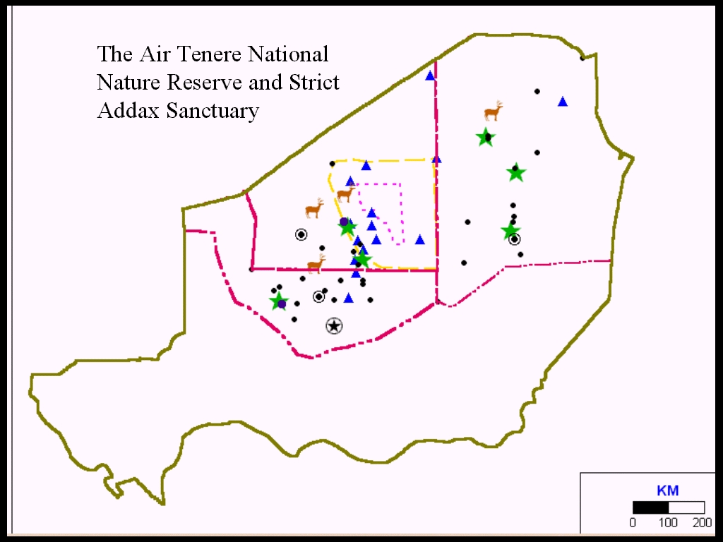
The two largest areas are the Air and Tenere National Nature Reserve and the Addax Sanctuary Strict Nature Reserve. (Figure 6). They are located on the edge of the Sahel and Saharan zones. "In other unmanaged parts of the Sahel the land can no longer sustain the peoples modest needs; pastures are overgrazed; soils are eroded; wildlife has disappeared." Thus perhaps protected areas have the potential for innovative management and habitat rehabilitation. (Newby and Wilson, 1993, p185)
The fact that the Air Tenere region in northern Niger was designated as a National Nature Reserve and not a National Park is very significant. Protected areas often restrict resource use by local populations. The different levels of access to resources are evident in the descriptions of IUCNs protected area classification categories.
<<http://www.wcmc.org.uk/protected_areas/data/sample/iucn_cat.html>> A National Park is a more preservationist designation and is set up to "exclude exploitation or occupation". A National Park is Category II whereas a National Nature Reserve is in Category IV according to the IUCN system. (WCMC 1992 Protected Areas) A Category IV area is a habitat/species management area which is
The National Nature Reserve as a whole
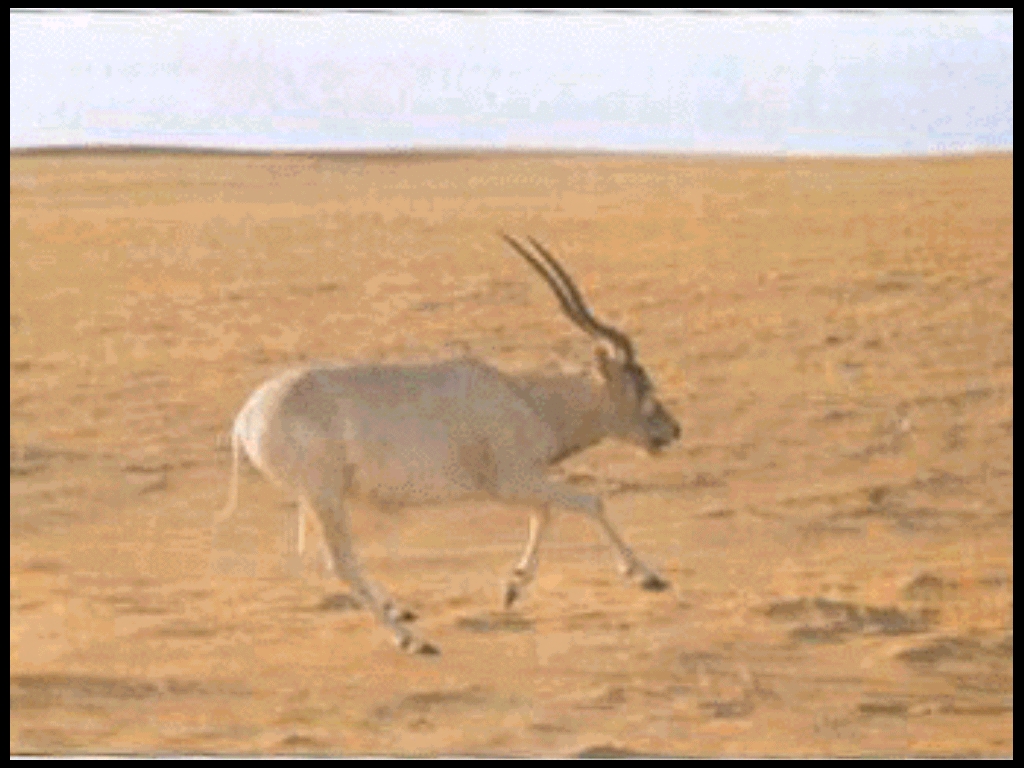
Figure 7. Say, 1989.
Figure 8. Say, 1989.
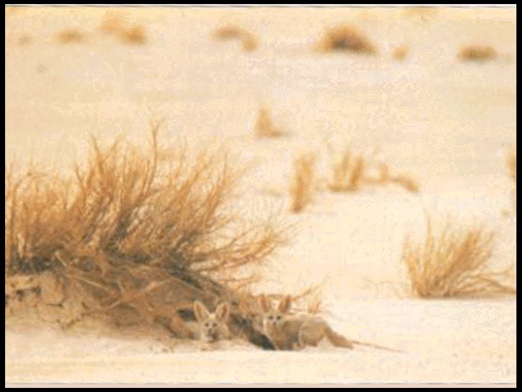
Figure 9. Say, 1989.
These reserves were gazetted in 1988 (IUCN, 1991, p201) and were declared a World Heritage site in 1991 by UNESCO in recognition of their natural and cultural resources. (WWF-Niger)
These reserves are located in the Department of Agadez in the Arrondissement
of Arlit. The Department of Agadez makes up most of the northern region
of the country. (Figure 10) It has a very low population density compared
with the other regions of Niger. (Figure 11) In 1988 its population density
was only 0.3 people/sq. km while the density of the whole country was 5.7.
(Ministere de Developpement Social, 1988) The population of the Department
has been relatively stable from 176,900 in 1984 to 189,000 in 1990. (Figure
12) The population of the city of Agadez (Figure 13), however, has been
increasing from 10,000 in 1971 to around 50,000 in 1991. (Figure 14) The
reserves are located between 17° 12¢
North and 20° 30¢
North and 08° 06¢
East and 10° 57¢
East. (Messa, Internet) "The reserves encompass a variety of arid and hyperarid
habitats, ranging from the regs (tracts of stony desert) (Figure 15) and
ergs (areas of shifting sand dunes) (Figure 16) of the Tenere to the more
clement mountain and valley habitats of the Air Massif." (Newby and Grettenberger,
1986, pp249-50) (Figure 17) There is also a range of elevations within
the reserve area beginning at around 500m in the Tenere and rising to 1,998m
at the summit of Mt. Tamgak. (Newby and Grettenberger, 1986, pp250). (Figures
17 and 18) The Air region is "both topographically and biologically more
diverse than the lowland, desert and sub-desert habitats surrounding it."(Newby,
1992, p19) (Figure 19) The climate is this region is extreme. Annual temperatures
range between 0-50 degrees centigrade and annual rainfall is between 0-75mm.
In addition rainfall is spatially and temporally highly erratic and unpredictable.
(Newby, 1990, p54)
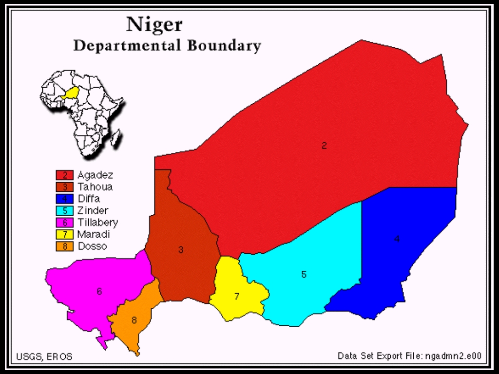
Figure 10. USGS
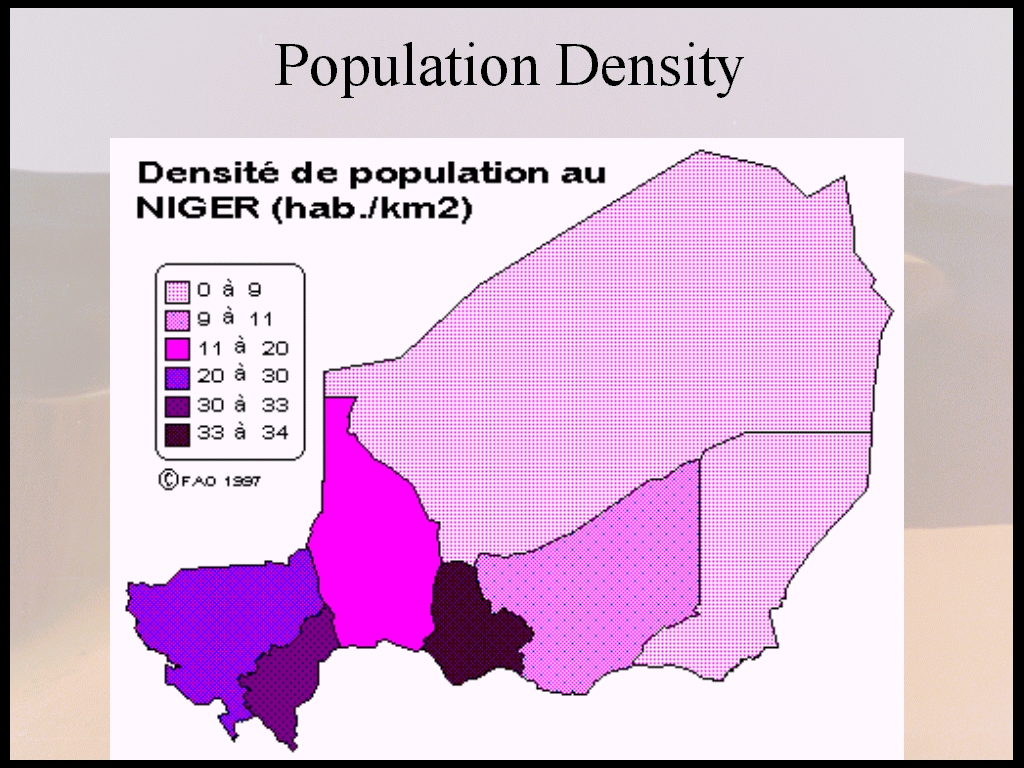
Figure 11. http://www.fao.org/WAICENT/faoinfo/economic/giews/french/basedocs/ner/
nerpop1f.stm
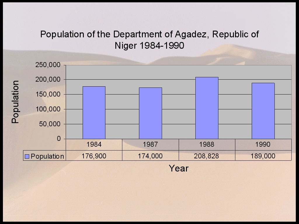
Figure 12. Britannica 1987, 1988, 1997, 1998, Ministere de Developpement,
1988
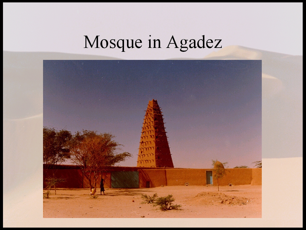
Figure 13. http://www.unesco.org/delegates/niger/agadez/.htm
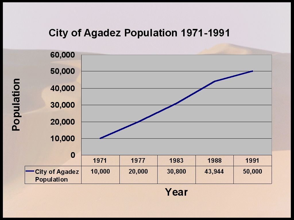
Figure 14. Atlas of Africa, 1993, Atlas du Niger, 1980, Atlas Jeune
Afrique, 1994, Britannica, 1990, 1992, 1996, 1998
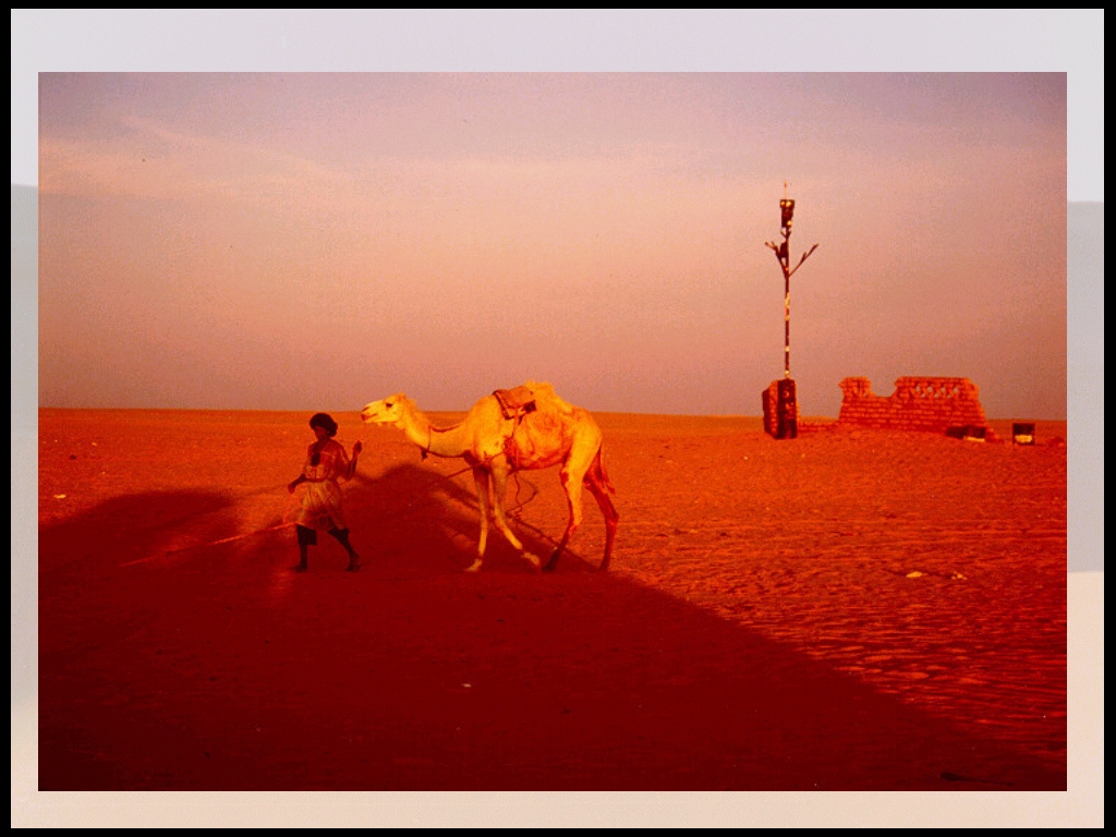
Figure 15. Newby and Grettenberger, 1986, pp249-50
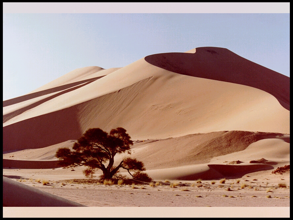
Figure 16. Newby and Grettenberger, 1986, pp249-50
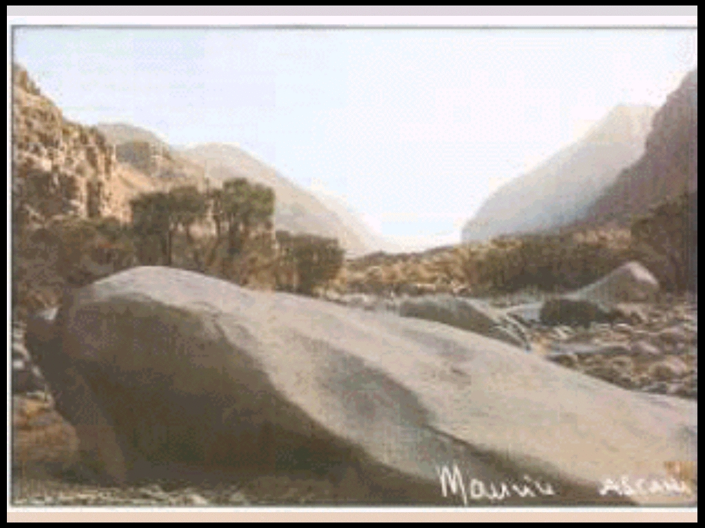
Figure 17. Say, 1989.
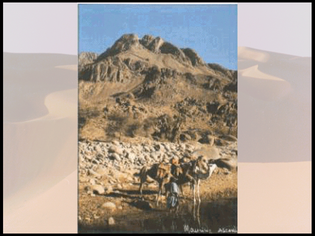
Figure 18.
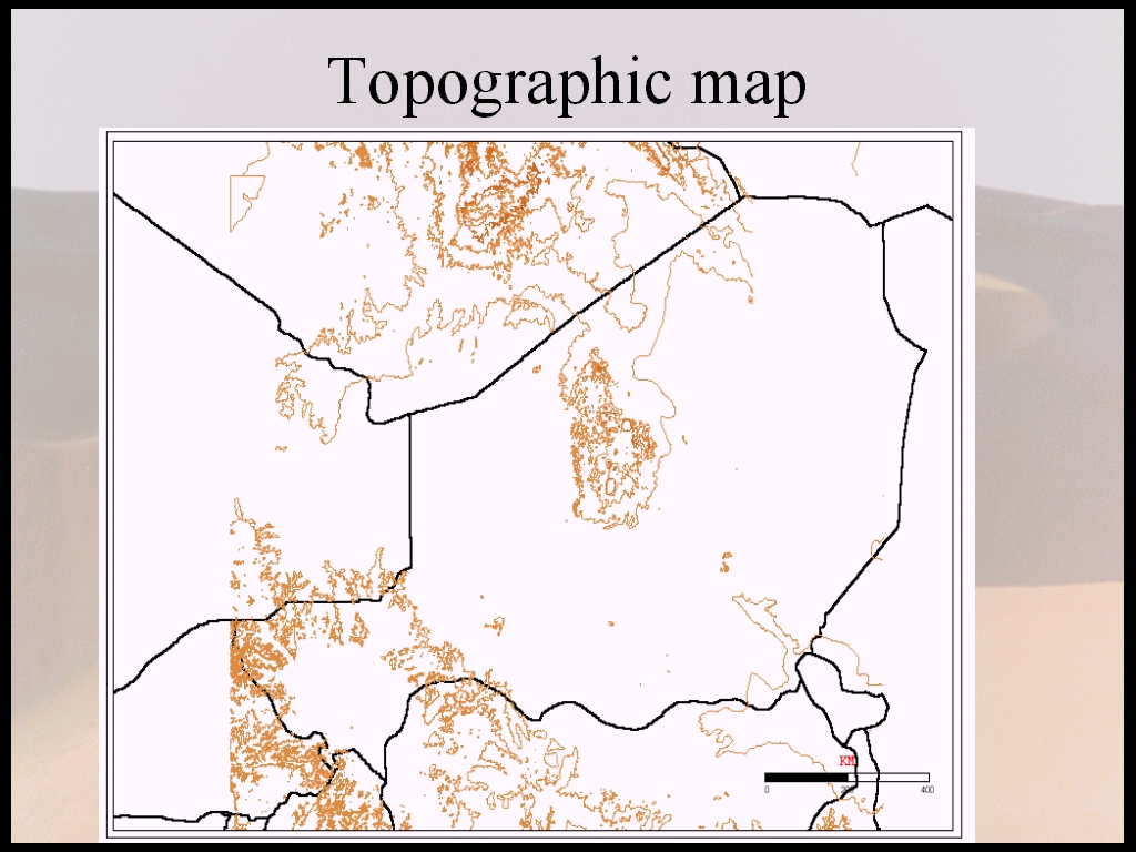
Figure 19. Digital Chart of the World-Topography
This erratic rainfall does not allow agriculture as is practiced in
the southern regions but there is an area within the microclimates of the
Air where there are some wheat and rice is cultivated. (Figure 20) In this
northern region, however, most people are pastoralists.(Figures 21 and
22).
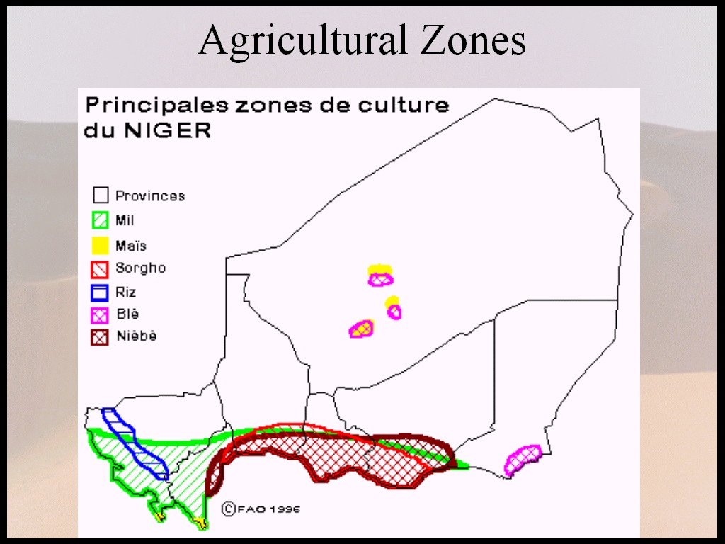
Figure 20. http://www.fao.org/WAICENT/faoinfo/economic/giews/french/
basedocs/ner/nercul1f.stm
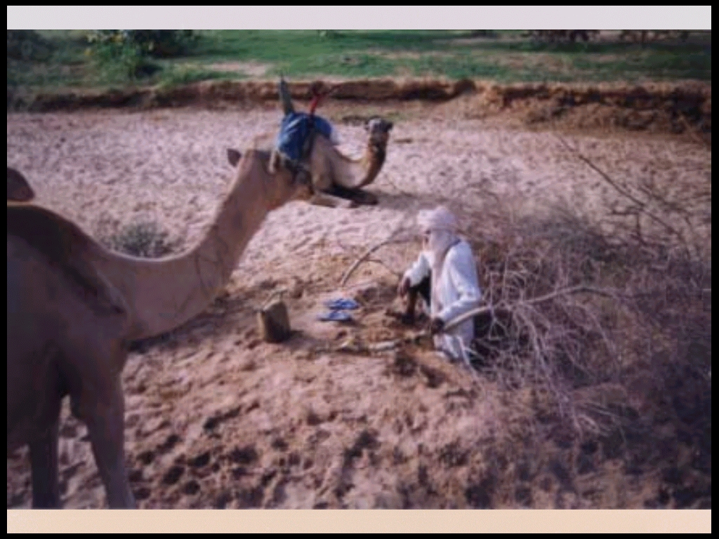
Figure 21.
.
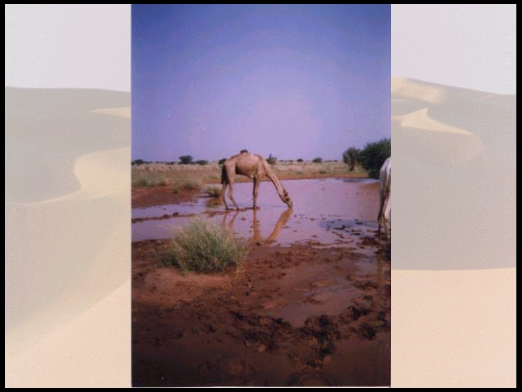
Figure 22
The people living in and around the reserve are Tuaregs. The Tuareg people are Zenaga Berbers from the north who came to the Air in about the seventh century. There are many now living in the center and western areas of the northern part of Niger. (Atlas of Africa, 1973, p136) "They are a fiercely independent and proud people who have roamed the arid land of Niger and the other West and North African countries for centuries". (Newby and Wilson, 1993, p179)
The Tuaregs (Figures 23, 24, and 25) are an ethnic minority of the population
of Niger and have varied from 3 to 10% of the population from 1977-1988.
(Figure 26) The Tuareg population is estimated to be 5000 in the Northern
Air (Newby, 1992, p22) and 7000 in the region (New York Times, 1988). There
are about 4500 Tuaregs (Newby, 1990, p54; Wells and Brandon, 1992, p73)
living in the reserve area of 77,360km2. However, the majority of this
population is concentrated in the villages of Iferouane (Figure 27) and
Tin Telloust (Newby, 1990, p54) In 1988, 1,500 lived in Iferouane (New
York Times, 1988). In 1977, however, the population of the area was 2,500-3,000
with 1,200 sedentary in and around Iferouane with other small sedentary
populations by the gardens at Tin Telloust and Zomo. The rest of the population
is pastoralist in and around the Air Massif. (Newby and Grettenberger,
1986, pp 251-2)
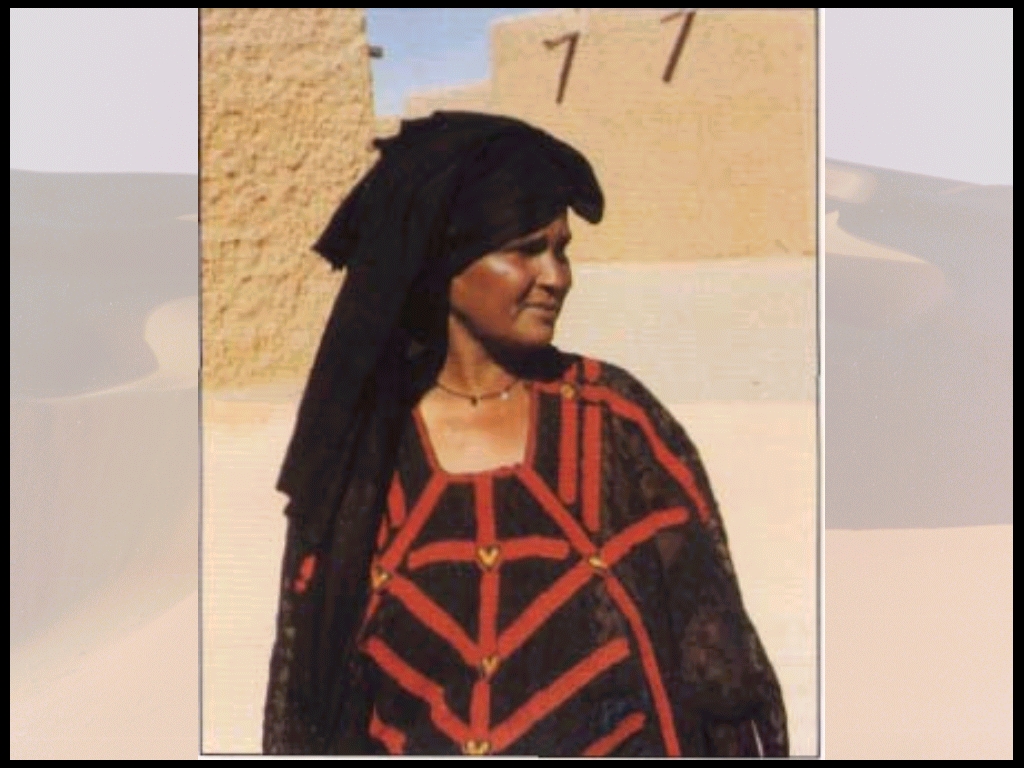
Figure 23.
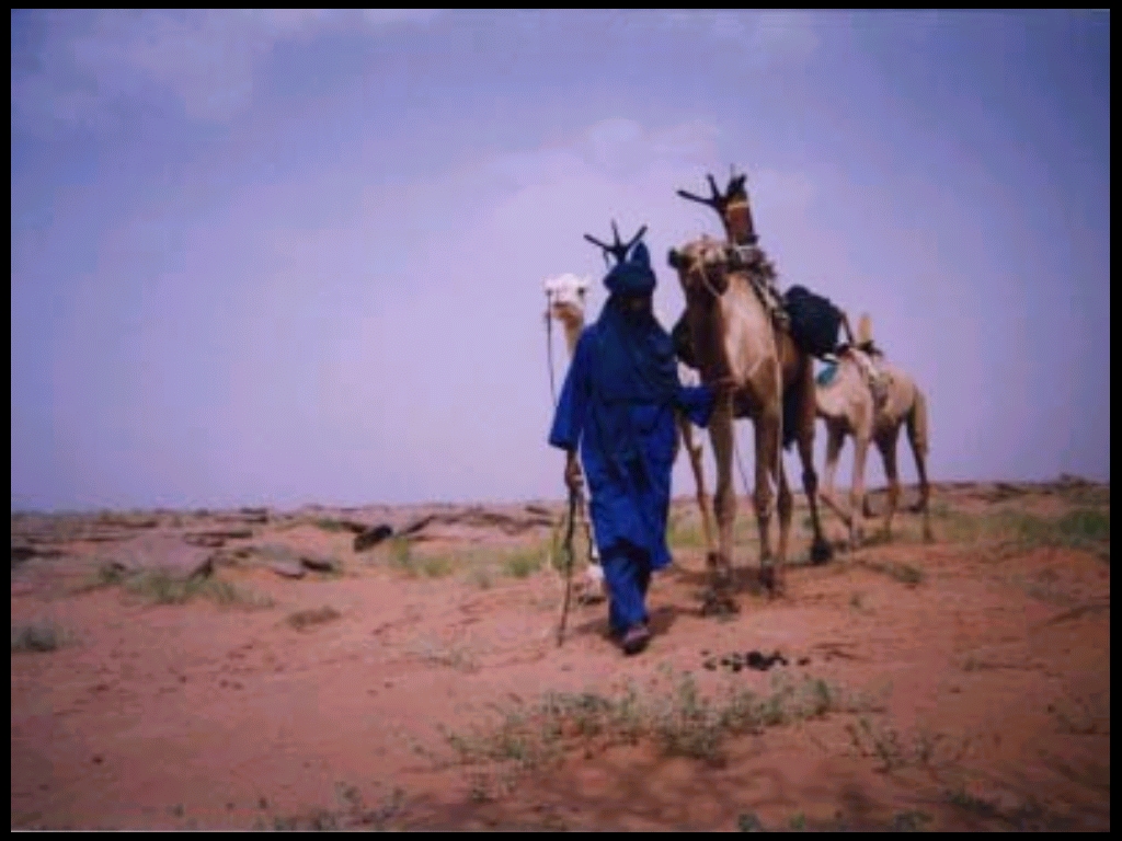
Figure 24.

Figure 25.
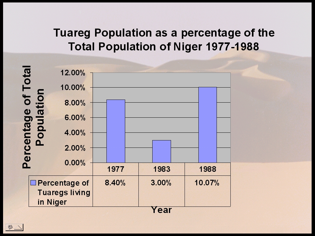
Figure 26. Britannica Book of the Year Volumes 1989,1991, 1992, 1996,
1998
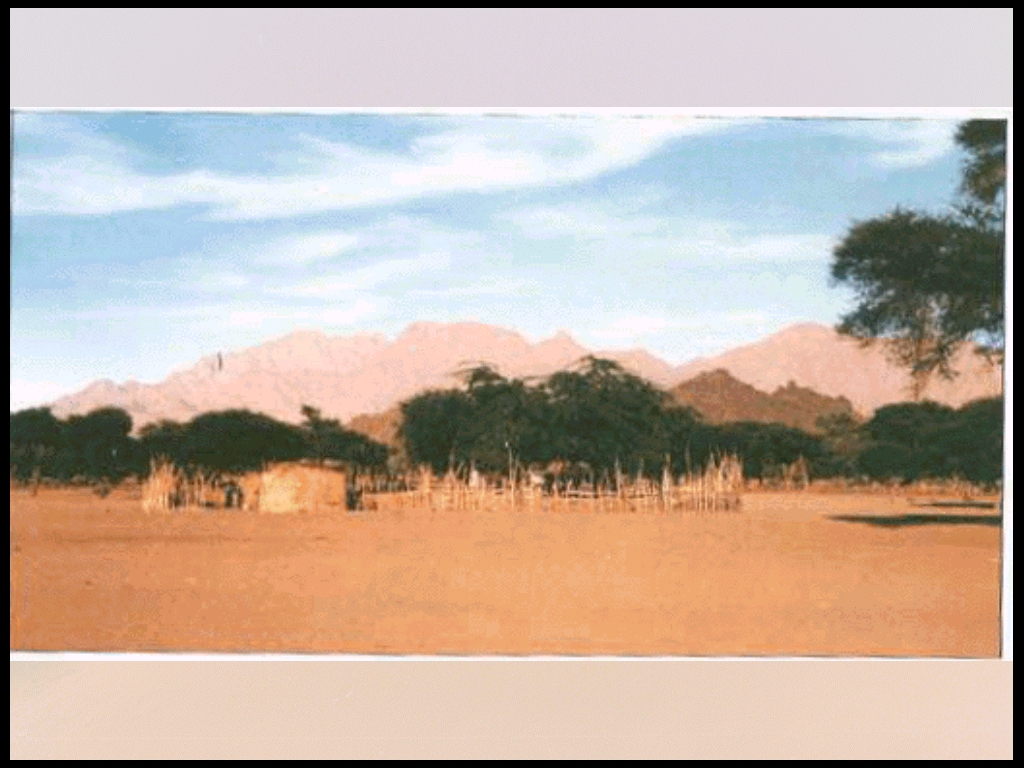
Figure 27. Say, 1989.
The main livelihood of the Tuaregs is herding camels, goats, and sheep
and farming small irrigated plots of wheat, maize, onions, tomatoes, and
spices. Many Tuaregs are still involved in the caravan trade "between the
Air, the salt and date-producing oases of Bilma and Fachi, and the sub-Sahelian
grain-producing regions of Niger and Northern Nigeria." (Newby and Grettenberger,
1986, p251) (Figures 28 and 29) However, this caravan trade is not so prevalent
now due to lack of camels, drought, and competition from motorized transport.
(Newby, 1990, p54)
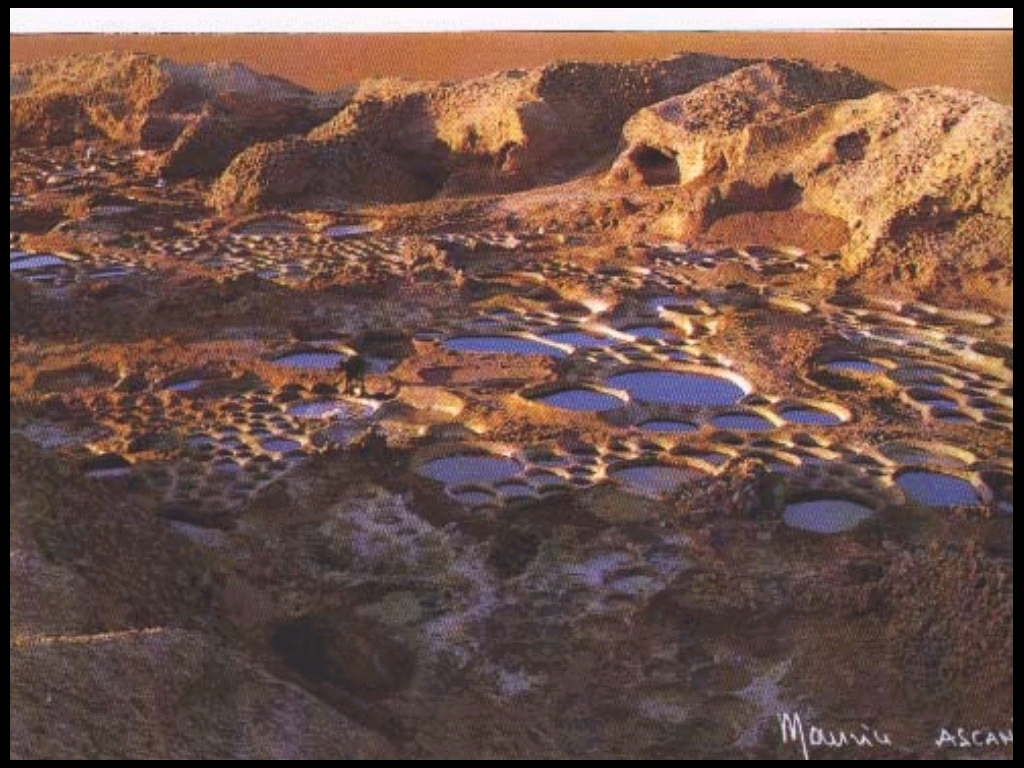
Figure 28. Say, 1989.
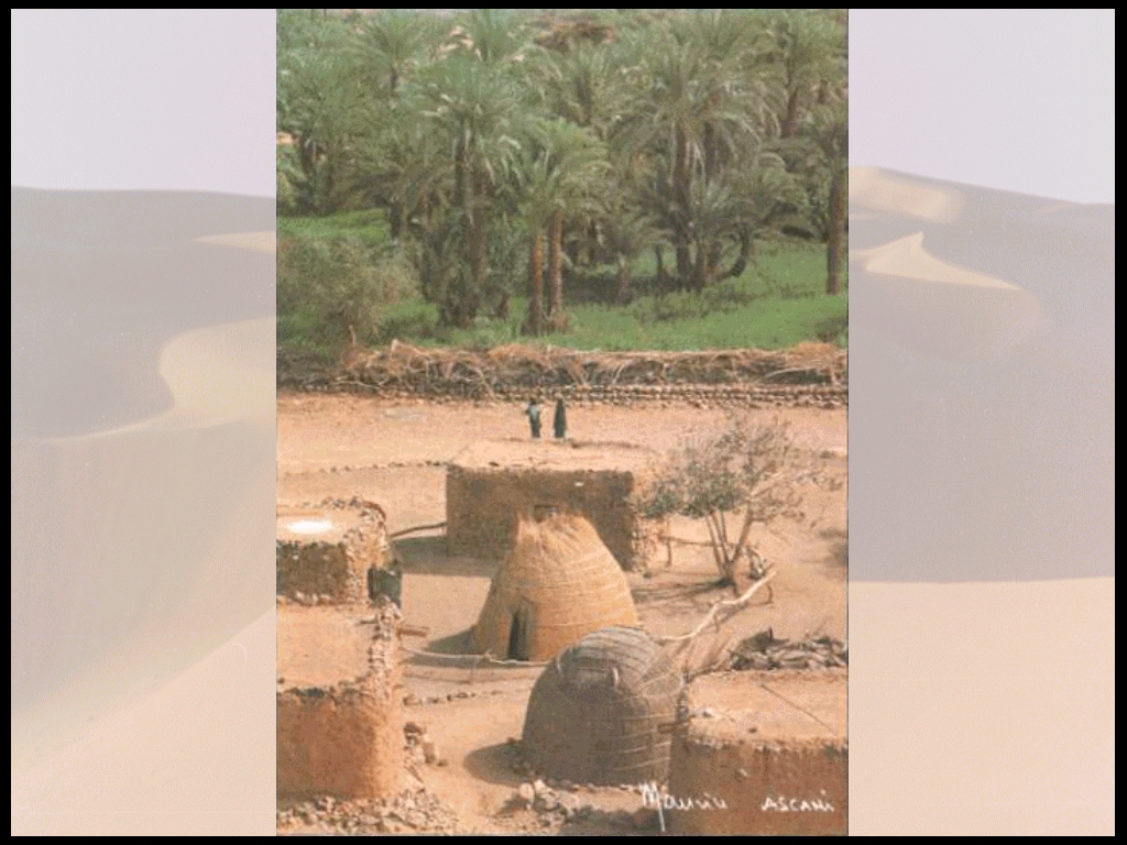
Figure 29. Say, 1989.
Newby says that there is a "rude but effective balance between the Airs relatively small human population and its natural resources". This is partly due to the isolation, sparsity of resources and extreme climate. It is during periods of drought, however, that that the "demand on limited supplies of water and vegetation increases and if prolonged leads to crop failure, widespread overgrazing, loss of livestock, mass exodus of the human population and not infrequently, death from disease or starvation."(Newby, 1992, p22)
One underlying goal of the management plan for the Reserve area was to maintain to the extent possible the traditional forms of land use and to not have to remove or hamper the resident people (Tuaregs) who rely on the reserve. (Newby, 1984)
Although people in the area used to hunt for food, wildlife is too rare and difficult to hunt today.
There were five main factors, which spurred the creation of the protected area:
In addition, however, there were certain factors, which led to the selection of the specific site as the reserve. It is essential to examine these along with the successes and failures of the reserve to be able to evaluate these criteria.
The ten criteria are:
WWF states the objectives of the projects as "1) To promote the conservation of flora and fauna, sustainable land use, and development 2) To improve the livelihood of the local people 3)To train people in natural resource management" (WWF-Niger) WWF then divides the activities of the project into the categories of infrastructure development, conservation and rehabilitation of natural resources and rural development. Infrastructure development includes recruitment of personnel, construction of staff housing, maintenance of vehicles, training for local masons in adobe constructions, staff training in conservation and natural resource management, and strengthening the central wildlife services. Conservation and rehabilitation of natural resources includes improvement of conservation of flora and fauna and historic/cultural sites, boundary demarcation, conservation awareness among local people, tourism control, collection of data on natural resources, a monitoring program for changes in natural resources and ecological processes, protection of important plants (genetically, economically, aesthetically), advice and assistance to local authorities on afforestation schemes, and analysis of habitat use by livestock. Rural development activities include
The civil war was a result of years of tension between the Tuareg rebel group and the government of Niger. "In recent years they [the Tuaregs] have tried to shake off years of domination under colonial rule and have increased their demands for recognition in a more equitable sharing of resources". (Newby and Wilson, 1993, p179) The Air became a "strategic stronghold for dissident Tuareg"(Newby and Wilson, 1993, p179) In 1992 the Director of the Air Tenere Conservation and Development Project was kidnapped and taken hostage by rebel forces" and presumably killed. (Slavin, 1996, p51) A month after this rebels attacked Iferouane where the reserves project headquarters was located. They took project vehicles, radios, tools, tires and a hostage. IUCN and WWF decided that project activities should be suspended temporarily. (Newby and Wilson, 1993, p179) One can speculate that the attacks were focused at the project Director and goods in order to make a statement that the Tuaregs didnt want outside interference in their region in the Air. By taking goods they gained materials for their rebel activities and by kidnapping the Director they drew international attention to their cause. However, once the conflict left the protected area zone some Tuaregs who had helped in the planning and creation of the reserve and its other conservation-related activities began to restart the project. This transition to local initiated projects showed that the management scheme that had been put in place was a sound one.
According to Newby and Wilson, there have been two key factors in the success of the project. First, there was a network of voluntary representatives of the Tuareg involved in the Reserve management. Local support grew from the obvious amelioration of rangelands within the reserve due to the projects interventions but also from the "Tuaregs traditional love and respect for wildlife and their concern that it was fast disappearing". Secondly, the appropriate technology components of the rural development activities were well accepted by the Tuaregs. (Newby and Wilson, 1993, p184)
Most local people hope that the project will continue. In order to do so the Tuaregs chose five representatives from among themselves to negotiate with IUCN, WWF, and the Nigerien government for moral and technical support. They also formed a Provisional Committee to supervise watershed management, tree planting and well maintenance activities. (Newby and Wilson, 1993, p185)
Thus the whole management of the reserve went through a major transition when the project director was killed. IUCN and WWF pulled out. But instead of transitioning to yet another failed project, left to fade away in the absence of outside management the project transitioned to be managed by local control.
Whereas there was the potential for a positive transition to the rural development and conservation activities by the local people with local supplies and knowledge in the absence of outside support, ecotourism went through a negative transition.
One of the reasons that the Air Tenere region was chosen for the site of the Reserve was its high tourist potential. (Newby 1984, p134) Before the civil unrest in the area several thousand tourists visited the Reserve each year. The tourism benefited the local economy but also posed a threat to the wildlife (tourists chasing wildlife in desert vehicles). Thus stronger regulations were needed. Even so, local people needed to receive more of an economic benefit from the tourists. Thus, an information center was built along with a craft shop and local guides were trained to take tourists on treks. The civil unrest in the area caused the termination of weekly flights from Marseille, France to Agadez, which brought the majority of the tourists. Those who came from the south have been greatly reduced due to the danger of entering the area. Although there was a peace accord signed in October of 1994 that provided for an eventual limited autonomy (Britannica, 1998) for the Tuaregs, the northern region remains unsafe for unescorted travel.
There is still rebel activity in the area and the U.S. State Department travel advisory states:
Therefore, the example of the Tuaregs and the Air Tenere Reserve serves as an example of a politically unstable region where the integration of the local people into the management of their biodiversity conservation in the form of conservation and rural development activities is vital to the success of the project. In this example there was a transition from the implementation of the IUCN/WWF project under relatively stable political conditions through the murder of the Director and the temporary suspension of the project to the point where local people were taking the initiative to restart the project. This was possible because of the local peoples participation in the management before the project pulled out. Their previous involvement and the focus on appropriate conservation and rural development activities was key to their ability and desire to continue the project. Ecotourism activities, which rely on outside clients, were hurt whereas, activities using local appropriate technology and local materials were restarted by the locals.
Bibliography
The Atlas of Africa. Editions Jeune Afrique. The Free Press, NY. 1973.
Atlas du Niger. Les Atlas Jeune Afrique. Editions du Jaguar, Paris. 1980.
Atlas Jeune Afrique du Continent Africain. 1994. Editions du Jaguar, Paris.
Britannica Book of the Year Vol. 1985-1998.
Brooke, J. "Niger Works to Save a Species and Bolster a Tribe". New York Times, May 9, 1988.
CIA. 1997 World Factbook: Niger. Retrieved 11/7.
http://www.odci.gov/cia/publications/factbook/ng.htm
IUCN. Niger In Protected Areas of the World: A Review of National Systems. Vol. 3:
Afrotropical. IUCN, Gland, Switzerland. 1991.
Messa, E. Les Reserves Naturelles de LAir et du Tenere. Retrieved 11/7:
http://cons-dev.univ_lyon1.fr/NIGER/PARCAIR/parcair.htm
Minstere du Developpement Social, de la Population et de la Promotion de la Femme.
Direction de la Population, Census 1988, Niamey, Niger.
Newby, J. and A. Wilson. People in Blue: The Tuareg of Niger In: The Law of the Mother: Protecting Indigenous People in Protected Areas. Ed. E. Kemf. Sierra Club Books. San Francisco. 1993.
Newby, J. "Parks for peoplea case study from the Air Mountains of Niger". Oryx, Vol. 26, NO. 1, January 1992.
Newby, J. Niger: The Air-Tenere National Nature Reserve In: Living with Wildlife: Wildlife Resource Management with Local Participation in Africa. Agnes Kiss (ed). The World Bank. Washington, D.C. 1990.
Newby, J and J. Grettenberger. "The Human Dimension in Natural Resource Conservation: A Sahelian Example from Niger". Environmental Conservation. Vol. 13. No. 3. Autumn 1986.
Newby, J. The Role of Protected Areas in Saving the Sahel In: National Parks, Conservation and Development. J.A. McNeely and K.R. Miller (Eds). Smithsonian Institution Press. Washington, DC. 1984.
Say, B. M. Le Niger et Ses Merveilles: Niger and its Wonders. Imprimerie Brunaud. Lyon, France.1989.
Slavin, T. Men In BlueThe Twareg of the Air and Tenere Reserve In: Managing
Conflicts in Protected Areas. Connie Lewis (ed.). IUCN. 1996. UNESCO.