Wetlands
Web Module
Scott J. Conaway
Alejandra De Obeso
Dr. Nihat M. Gürmen
Prof. H. Scott Fogler
 Background
![]()
![]()
![]()
CONSTRUCTED WETLANDS
Constructed wetlands are created wetlands designed to improve water quality, be it municipal or residential wastewater, stormwater run-off, industrial and agricultural wastewater, landfill leachate, acid mine drainage, or polluted groundwater. There are two basic types of constructed wetlands: surface flow wetlands and subsurface flow wetlands.
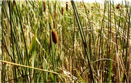
Surface flow wetland - Image courtesy of HYDRA
http://www.hydraaquatic.com/wastewater.htmlSurface flow wetlands look and function much like natural wetlands. The portion of the plant stems that is underwater acts as a substrate for bacteria and other microbes which provide most of the water purification functions. There are several processes involved in this kind of purification, such as sedimentation, filtration, precipitation, flocculation, and biochemical transformation.
Surface flow wetlands are frequently used as a means of substantially reducing biological oxygen demand (BOD), total suspended solids (TSS), and total nitrogen (TN), as well as many other waste stream constituents. They are especially useful as a polishing step following conventional treatment processes such as lagoon systems, activated sludge, extended aeration, or subsurface flow wetland treatment systems.
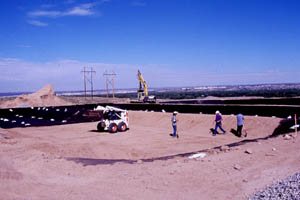
Subsurface flow wetland under construction - Image courtesy of HYDRA
http://www.hydraaquatic.com/wastewater.htmlSubsurface flow wetlands are usually shallow gravel beds through which water passes horizontally. The extensive root system of the wetland plants growing in the gravel media provides substrate for the microbial communities responsible for the reduction of common pollutants. These systems use impermeable liners to prevent groundwater contamination.
However, there are some factors that may limit the applicability and effectiveness of the process:
Employing specific plant species that target particular contaminants at a site can be difficult if the species does not adapt properly.
How exactly could we model one of these systems? Several research hours have been spent trying to answer that question. Fluid mixing in the wetlands is not that satisfactory, and this factor limits the application of a CSTR model. Therefore, we will model one of the wetlands at the Des Plaines River Wetlands Project using a PFR.
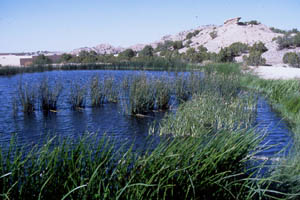
THE DES PLAINES RIVER WETLAND PROJECT
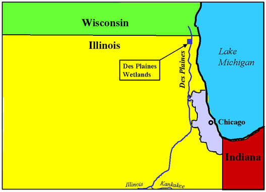
The Des Plaines River is located in southern Wisconsin and northeast Illinois, shown on the image below. It runs along the city of Chicago and finally empties into the Illinois and Kankakee rivers.
Image courtesy of R.H. KadlecThe Des Plaines River Wetlands were constructed as illustrated in the aerial photograph. Water is pumped from the river to the left side of EW3 and the top of EW4, EW5, and EW6. The discharge of the wetlands is controlled by flow weirs. EW3, EW4, and EW5 all discharge to a common outlet before reentering the river whereas EW6 discharges into a lake before reentering the river. The lake was left out of the photo, but it is located on the left of EW6.
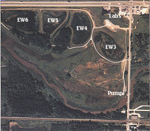
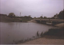
Image courtesy of R.H. KadlecThe Des Plaines river can rise and fall rather significantly. The images below were taken at roughly the same location on the river. The one on the left was taken in May of 1989 and shows the river under normal conditions. The picture on the right was taken during August of 1988 and shows the river under drought conditions.
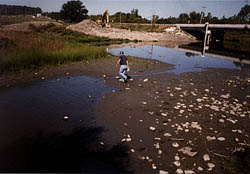
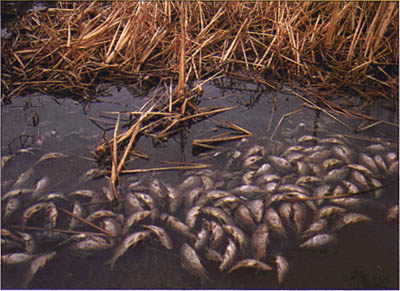
Images courtesy of R.H. KadlecThe Des Plaines River is classified as being semipolluted. Turbidity is a primary problem with total suspended solids (TSS) mean concentration being 59 mg/L. Data shows that experimental areas trapped 88% of the sediments contained in the incoming river water. The level of TSS started to rise unexpectedly in the summer of 1990. It turned out that a large number of carp had started inhabiting the wetlands, and as they scavenged for food they stirred up the bottom and resuspended the solids in the water. The carp were intentionally frozen out in order to return the wetlands to their previous high efficiency removal.
Image courtesy of R.H. KadlecThe wetlands also eliminate other pollutants, including phosphorus and atrazine. The ecosystem extracts 65 to 80 % of the phosphorus from the river water. Removal is generallly better in the summer, since the concentration of phosphorus is so low during the winter that it is impractical to filter it out. Much of the water that enters the river in the winter is run off over frozen land, ice or snow. On the other hand, atrazine is a herbicide that is used in the area. At times, levels in the river peak above the federal drinking water standard. Atrazine was found to degrade on sediments in the wetlands according to a first-order rate law. Therefore, levels of atrazine in the outflow of the wetlands are lower than the river inputs.
Current Status of the Des Plaines River Wetland Project (2004)
As of 2004, the Des Plaines River is now visible through a rehabilitated oak grove, originally covered by a wall of weedy vegetation. Restored prairies are increasing in diversity, which support a wider variety of fauna and flora species and indicate the development of a complex wetland ecosystem since 1990. By 1991, the macroinvertebrate community in the wetlands was made up of 60% snails, an important part of both temporary and permanent wetland habitats. Beavers and muskrats have returned to the site in force. Thirty-six different fish species have been observed on the site, up from only 20 species before the restoration work. As for endangered fauna, five state-designated bird species are breeding in the site (sandhill crane, yellow-headed blackbird); another 16 endangered species have been observed as migrants at the site (red-shouldered hawk, Henslow's sparrow).
The efficiency of the experimental wetlands to purify water has also been confirmed. The experimental wetlands have trapped more than 80% of the sediments and nutrients contained in the incoming river water, delivering clear water back to the Des Plaines. Additionally, groundwater is being recharged and base flow has been increased. Information obtained from the Project shows that the use constructed wetlands for water quality improvement of an entire watershed would require converting only 2 to 4% of the land area to this use.
As for the Des Plaines community, their response to the project has been very positive. Joggers, bikers, and equestrians make use of the trails and roads on the site, while fishermen visit the river, wetlands, and quarry lakes. The site also serves as a hands-on classroom for dozens of local biology and ecology students each year. The information gathered at the project site provides new data about how -and at what cost- wetland ecosystems can be reestablished and used to manage the country's water and wildlife resources.For additional information, feel free to visit the Wetlands Research, Inc. website.